


onX Offroad Premium Membership
Make your off-road maps Elite with private land boundaries and ownership information for the entire country.
Reviews
5 (2)
Community Photos
Photos tagged with this product.

Have a question about onX Offroad Premium Membership?
For the best experience download our app!


About onX Offroad Premium Membership
Better Adventures For Less Than a Tank of Gas
onX Offroad Premium is the perfect affordable tool with everything you need to find off-road and snowmobile trails and open riding areas. Find camping with public land boundaries, save unlimited Offline Maps, customize your maps with Waypoints, and Track your trips to save and share with friends and family.
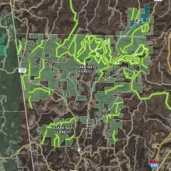
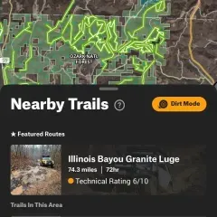
Nationwide Off-Road + Snowmobile Trails
Find the off-road trails you want fast. Color-coded trails let you see which are open at a glance. Filter your map for 4×4, SxS, dirt bikes, ATV, and snowmobiles; and tap on any of the 615K miles of trails for a detailed overview that includes distance, open and closed dates, width, and more. Switch to Snow Mode to locate snowmobile trails and backcountry riding.
Get Home Safely—From Anywhere—With Offline Maps
With onX Offroad Premium you can save custom-size Offline Maps to bring your adventure along when you’re outside coverage on the trail. Navigate by following the blue dot from your phone’s internal GPS, and always know how to get home–wherever home is that night.
Escape the Crowds + Own Your Public Lands
Color-coded maps with clearly marked Public Land boundaries build right in make it easy to know where you can off-road and find dispersed camping. Tap on any piece of Public Land to access our library of map data including land-type designation, links to agency websites, nearby trails, and local weather.
The Benefits of Upgrading to Elite
Along with access all of Premium’s features, you’ll see nationwide private land boundaries and ownership information across the country. When you go Elite, you also unlock exclusive industry discounts on gear and services with our trusted brands and partners.
| Premium | Elite | |
| Partner Discounts (Elite Benefits) | x | |
| Property Boundaries | x | |
| Land Info (Owner + Area Acres) | x | |
| Featured Trails | x | x |
| Trail Status | x | x |
| Photo Waypoints | x | x |
| 3D Maps | x | x |
| Government Lands | x | x |
| View / Submit Trail Report | x | x |
| Save Custom Routes | x | x |
| Aerial, Hybrid, Topo Basemaps | x | x |
| Folder Sharing | x | x |
| Customize Waypoints | x | x |
| Tracking | x | x |
| Localized Weather | x | x |
| Sync content to the cloud | x | x |
| Unlimited Saved Offline Maps | x | x |